Smarter Scouting
How Drones & Data Are Strengthening Integrated Pest Management

The core logic of integrated pest management (IPM) hasn't changed much since the concept took hold in the 1970s.
Scout the field, track crop development, compare observed pest pressure against established economic thresholds and treat only when and where the population justifies the cost of intervention. What has changed is the scale and resolution at which that scouting can happen, and the precision with which a response can be targeted.
Drone technology and variable-rate application systems are the latest tools to enter this framework. For operations managing significant acreage, they offer a way to gather better information faster and to act on it more precisely. Whether the investment makes sense depends on the operation, but understanding what the tools actually do — and where they fit within an IPM approach — is a useful starting point.
Scouting as the Foundation
IPM begins with monitoring, and monitoring begins with knowing what to look for and when. Crop development stage matters as much as pest presence: a corn rootworm population that would cause negligible damage at one growth stage can be far more significant at another. Tracking growing degree days and crop progress alongside pest populations is what allows threshold-based decisions to be meaningful.
Traditional scouting by walking transects, checking representative plant samples and recording counts remains the most reliable method for many pest and disease situations. Its limitation is coverage. A thorough scout on a large field takes significant time, and pest pressure can develop unevenly across hundreds of acres in ways that a standard transect pattern may not fully capture.
This is where aerial scouting tools have found a practical role. A drone equipped with multispectral sensors can cover large acreage quickly and flag anomalies, including areas of crop stress, unusual reflectance patterns or visible canopy gaps, that give scouts a more targeted starting point for ground-level investigation. The drone identifies where to look; the boots-on-the-ground work confirms what's there and whether it crosses an economic threshold.
What Drone Technology Actually Does
Multispectral cameras measure plant reflectance across wavelengths invisible to the naked eye, including near-infrared and red-edge bands. The resulting Normalized Difference Vegetation Index (NDVI) maps can detect crop stress days before visible symptoms appear, crucially narrowing the window between a developing pest or disease problem and a grower's ability to respond. Standard RGB cameras, available on less expensive consumer drones, can capture visible symptoms and canopy irregularities useful for basic scouting even without multispectral capability.
Flight data processes through software platforms such as DroneDeploy, Pix4D or AgEagle's FieldAgent, producing georeferenced maps that overlay existing field boundaries and flag problem zones by location. Those coordinates become the basis for targeted ground-scouting, and if treatment is warranted, a prescription map that guides variable-rate application.
Satellite imagery services offer a lower-cost alternative for operations not ready to invest in drone hardware, with some platforms providing weekly or more frequent field-level NDVI data as part of farm management subscriptions. Resolution is lower than drone imagery, but for large acreage operations the coverage-to-cost ratio can be favorable.
From Threshold to Treatment
Economic thresholds — the pest population level at which the cost of treatment is justified by the yield loss it prevents — are the decision point that separates IPM from calendar-based or precautionary spraying.
Drone and satellite scouting tools don't change how thresholds work, but they can improve the quality of the information going into the decision. Identifying a localized hotspot rather than assuming field-wide pressure means threshold assessments can be made by zone rather than applied uniformly across an entire field.
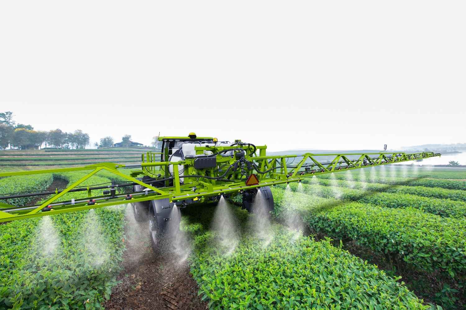
When treatment is warranted, variable-rate and spot-spray systems allow application to match the prescription. GPS-linked section control reduces overlap and enables zone-based rate adjustments on existing sprayer equipment. Individual nozzle control systems achieve finer resolution for situations where pressure is highly localized.
Published case studies on herbicide reduction through prescription-based spot-spraying show a wide range of outcomes, from 25% to 77% savings depending on crop system, weed pressure and field variability.
Fungicide and insecticide reductions tend to be more modest, typically 15% to 40%, reflecting more even pressure distribution. Fields with relatively uniform pest pressure across their acreage may see limited advantage over blanket application; the benefit scales with variability.
Evaluating the Investment
Commercial-grade multispectral drones run $10,000 to $25,000 depending on configuration, with software subscriptions adding $1,500 to $3,000 annually. Drone service providers offer an alternative at roughly $5 to $15 per acre per flight for operations not ready to own the equipment. Section control upgrades on existing sprayers typically run $5,000 to $15,000, and individual nozzle control systems represent a larger investment.
Extension economists generally recommend modeling potential savings against current input spend and field variability before committing.
An operation spending significantly on fungicides or herbicides across highly variable ground has a different calculus than one with uniform fields and moderate pressure. Most farm management platforms now integrate drone and satellite imagery and support the year-over-year comparisons that make that modeling more reliable in time.
What Fewer Sprays Add Up To
Reduced application volume carries implications beyond input costs. Fewer field passes mean less soil compaction and fuel use. More targeted treatment means less active ingredient moving through the broader environment, a consideration that aligns with both the original intent of IPM and growing expectations from retailers, processors and certifiers tracking on-farm sustainability metrics.
The tools themselves will continue to evolve, and long-term performance data is still accumulating across crop systems and geographies. But the underlying principle — that better information leads to better decisions, and better decisions reduce unnecessary inputs — is as central to integrated pest management today as it was before drones existed. The technology has just changed the scale at which that information can be gathered. The decision framework it serves remains the same.